Updated Map of the Impact Area
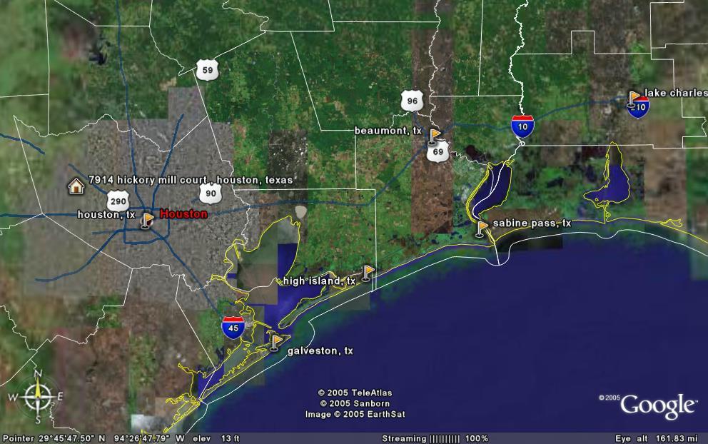 I have updated my Google Earth image to include the now newsworthy locations of Sabine Pass (expected landfall) and Lake Charles, LA, which will be heavily impacted by Rita. In the past 24 hours, landfall has changed from Matagorda, Texas, which is due south-southwest of our house toward the Texas Coast and has moved eastward amout 140 miles (224 km). While the area of landfall is less populated than the Houston area, many lives will yet be adversely affected by Rita. Hurricane force winds will extend to Galveston in the west and just past Lake Charles in the east.
posted by Anonymous at 5:30 PM
![]()

0 Comments:
Post a Comment
<< Home