Saturday, September 24, 2005

Good Bye, Rita!

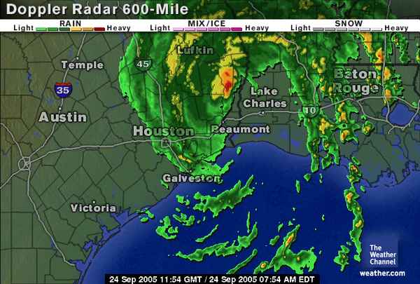
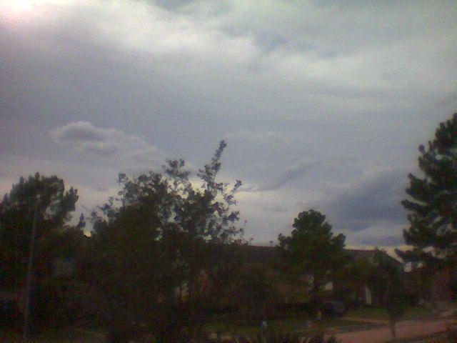
I thought we were near the end of this story, and wanted to close this blog of Hurricane Rita by about 1400h CDT. At approximately 1230h CDT our power went out. We have had very little rain, less than 0.5 inches (1.25 dm) by all accounts, and the wind finally died down around 1500h CDT. Our power was restored around 2000h CDT.

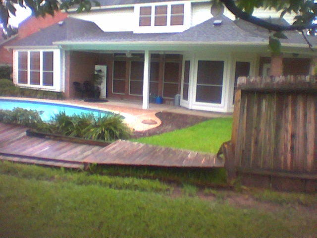
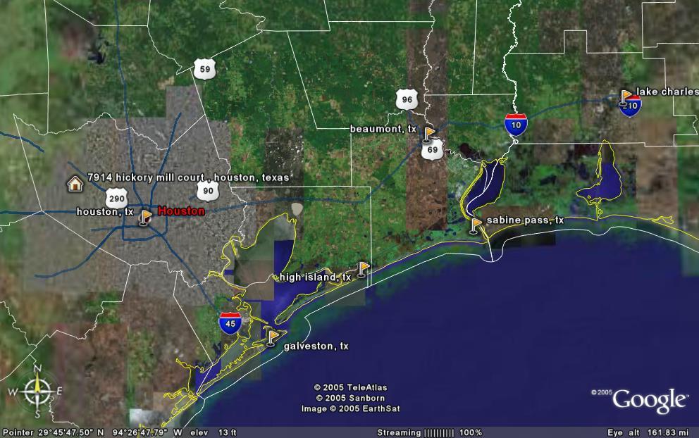
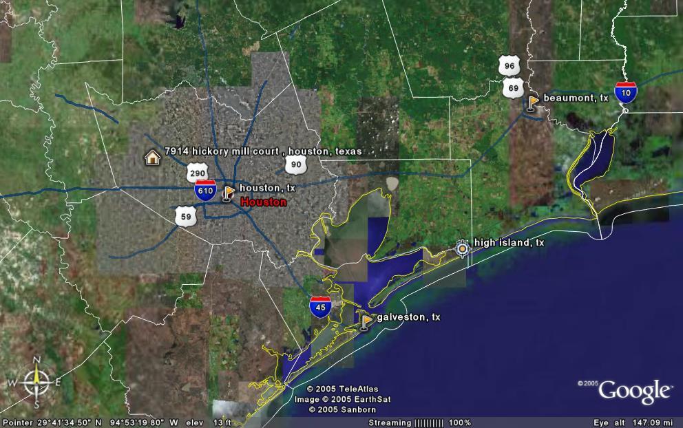
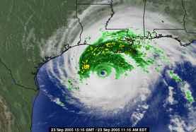
Wednesday, when I returned from an overseas trip, Rita was headed toward Matagorda, TX and we were on target for hurricane force winds of 100 mph (160 kmph). Over the two days that followed, landfall shifted east 140 miles, and all we lost was a fence. We are grateful. My daughter says it was anti-climatic, but losing a fence to a storm whose center was 110 miles (176 km) away is "climatic" enough for me.

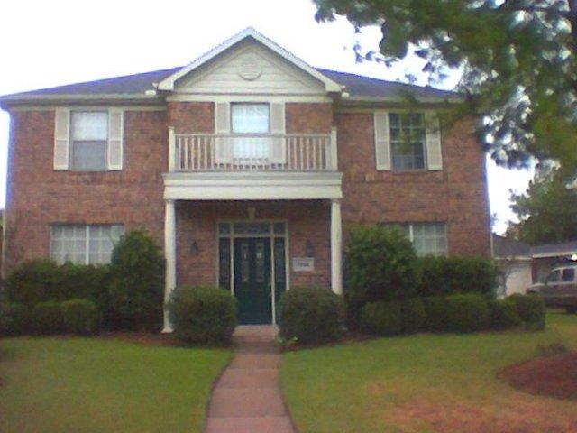
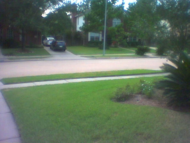
Things are normal now, except for the fence. The winds are back to normal, the skies are clearing, we can empty our water containers, move things back upon the deck, maybe get some gas in the Jeep. Normal officially begins tomorrow...

Thanks for sharing in this journey,

Mark

A Little Rain, a Little Wind, and Less Fence

We are now +8 hours of landfall. Another sky shot from the front door, a little over 24 hours after the first picture. It still looks like rain, but we have had very little rain. The wind remains strong. The clouds are more dispersed, not showing the ring/band patterns observed prior to landfall.


As I was getting ready to post this blog, our rainfall has just grown from "spitting" to "steady"...and the first claps of thunder.


Updated photo of our back fence. It surprises me that Rita caused damage from 110 miles away, and the wind gusts we are experiencing, sans water, can still take out a fence. Had there been rain with these winds, the damage throughout the neighborhood would have been greater. As is, this appears to be the only damage.


The boughs on our pine show the sustained 25-30 mph (40-48 kmph) winds we have seen all morning. Gusts were strong enough to move me while outside talking to a neighbor. He was sitting in his car, moving it from the driveway to the street while we spoke. He said the movement of the vehicle caused by the wind was quite noticeable.

First Assessments on the Day After

Morning after Rita's landfall, at my home roughly 110 miles (176 km) from the same. You can see a small pine branch down near the tree on the right, and a few of these dot the yard. All OK here. We are still experiencing sustained winds of 25-30 mph (40-48 kmph), with gusts up to 40 mph (64 kmph).


[Update 0920: suffering intermittent power outages of a few seconds duration; about half a dozen since 0800h]


Backyard is a different story. We lost the back fence. Gee, I didn't know these folks had such a nice pool! Total number of panels lost looks like five.

[Update 0820h: the fence is a total loss, as the structural integrity of the other posts have been compromised]
[Update 0900h: the panels to the right have been blown over]


I left my old running shoes on the window sill (accidentally) at the back of the house. I lose the fence, but the old 'dogs' stay. Go figure.

Updated Radar and First Post-Landfall Notes


From Weather.com: Rita at 0700 CDT.
We are located at about the 'o' in Houston.
Posted by Picasa

Here we now sit some four hours after landfall (landfall as a CAT 3 was 2:30 AM CDT). We have sustained winds between 25-30 mph (40-48 kmph). Wind speeds appear to be increasing, but I am judging that solely on what I hear. I suspect these are merely gusts. The rain has just begun at this time. We took a momentary power hit shortly after landfall, and another one just a few moments ago. I see no debris on our streets. We do expect more rain and wind as Rita moves inland, so this is not over for us.

Sunrise is at 7:11 CDT, and hopefully I'll post another picture or two at that time.

Again, friends, we are only seeing the very edge of the 'clean side' of Rita. Those in the Beaumont area were seeing 100 mph (160 kmph) 2 hours before landfall. Two days ago, the projections said we would be the ones dealing with hurricane force winds...

Pray for those in Rita's fury.

Friday, September 23, 2005

Hopefully, Sleep Will Come

We are three hours from landfall, which will be at Sabine Pass. She will make landfall as a mid-range CAT 3 hurricane. We are seeing wind, nothing dangerous, and very little rain. Galveston's historic Strand District has three buildings burning right now. We are now on the most outer fringe of the tropical storm winds. This means we are more likely to see 40+ mph (64+ kmph) winds rather than any closer to 75 mph (120 kmph).

I am headed to bed. Pray for the people of Beaumont, Port Arthur, and Lake Charles.


I will give an update in the morning...besides, Mick is quiet now so all must be well.

Last Light Before "Hunkering Down"

Night has fallen, and so has the first drops of rain. Mind you, not much yet, and on any other day one might think it was an anomalous cloud. Tonight, we know it is a beginning, however light. Rita's bands are noticeably on the move southward from us, lower, and more fully defined (top photo).


Neighbors meet for one last time to laugh and swap stories before "hunkering down" for the night. I filled up our last two coolers with water, and now all supplies are in place. The top and second photos were taken only a few minutes apart, and already the clouds have changed shapes and moved.


Last outdoor picture I'll be able to take before morning. The streetlight gives a calm glow to what we know will be a challenging night, and our night will be easy compared to our friends in the Beaumont area. This photo was taken about 20 minutes after the previous two. Winds are gusting to 30 mph (48 kmph).

Updated Map of the Impact Area

I have updated my Google Earth image to include the now newsworthy locations of Sabine Pass (expected landfall) and Lake Charles, LA, which will be heavily impacted by Rita. In the past 24 hours, landfall has changed from Matagorda, Texas, which is due south-southwest of our house toward the Texas Coast and has moved eastward amout 140 miles (224 km). While the area of landfall is less populated than the Houston area, many lives will yet be adversely affected by Rita. Hurricane force winds will extend to Galveston in the west and just past Lake Charles in the east.

Waiting, Landfall -7 to 10 hours

It looks like Rita has jogged again to the east, with the center of the projected path marking landfall at Sabine Pass (the Sabine River is on the Texas-Louisiana border). The east side of the storm is already yielding heavy rains, bringing more misery to N'awlins. On the west side of the storm, we continue to see cloud buildup, and the first 'rain clouds' have formed.

It is still 94 F here (34C), but once the rains come, it will cool before the temperature 'bounce back' once the storm passes. We expect rain, once it starts to continue for 24-48 hours.


We have been told (in our area) to expect about 8 inches of rain (203 mm), and such rainfall will bring water above the curb and to the sidewalk. Pretty minor overall, but enough to require my daughter to mover her Eclipse off the street and up into the driveway. Once the rain stops, the 'flooding' recedes fairly quickly. I will try to get a photo of this area during the deluge.

Clouds Continue to Build

Cloud density is increasing, and though it would be difficult to tell from the pictures, the wind is picking up. I have no way of measuring the windspeed, but it is about 10-20 mph (16-32 kmph). The winds will come from the North for us, as we are on the 'clean side' of the hurricane. We are now getting our timing in place for the last things that can only be done prior to the strike, and we must also take time-out for cake and celebrate my youngest daughter's 18th birthday.


All photos are being taken with my Nokia 3650, and the color variation is not real. I am not going to worry about editing them, however. The picture to the left shows a little more detail in the band development.

About 24 Hours from Landfall

The image above was created using Google Earth to show where we are with respect to all the places being discussed concerning Rita's landfall. Right now, landfall is slated for High Island, which is 80 miles from our home. Earlier this morning, Beaumont was the projected landfall, so Rita is jogging back and forth as she gets closer to shore. The core of Rita, representing hurricane force winds (> 75 mph or 120 kmph), is 75 miles in radius at this time. We may experience these winds, but will at least get tropical storm force winds (> 40 mph or 64 kmph).

Looking out my front door to the NW as the clouds continue to become more dense.

First Blog on Hurricane Rita

Friday morning Satellite
We have moved all loose deck and lawn items into the garage, especially the plants, which could become 100 pound (48 kg) projectiles if left outside. This afternoon we will load all our water containers and fill the tubs, after our pre-hurricane showers, of course. We have plenty of food, and the flashlights have sufficient battery supplies.

The image at the left is taken from the weather.com website, and is used only to give a perspective to the blog.

Outer Cloud Bands of RitaThe picture at left shows the outer cloud bands of Rita September 23, 2005 at 1000h. The photo is looking NW. We expect these to intensify and eventually bring wind and rain. The winds in our area are projected to between 40 mph (64 kmph) and 75 mph (120 kmph).